lydamorehouse: (ichigo freaked)
 The perfectly reflective Clam River (Wisconsin.)
Image: The perfectly reflective Clam River (Wisconsin.)

Shawn and I went back to the quilt show in Weber, Wisconsin, to see which ones won, and on the way back to our friends' cabin we spotted a sign that said "Clam Dam." HOW DO YOU RESISTS CLAM DAM???  So, we turned down the road and followed the signs to the quirky little public park around the dam that dams the damn clam river.


Shawn crossing the damn dam
Image: Shawn crossing the damn clam dam.

The park, as my grandmother might have said, wasn't much "to write home about," but today is just such a lovely day that we spent a good half hour just sitting on the banks of the river, listening to the water flow, and watching the waves leap and pop, sending spray up into the air.

A rotted fence in Clam Damn Park
Image: a moss-covered rotting wooden fence in Clam Dam park. 

The damn narrow dam walkway
Image: The damn narrow dam walkway.
lydamorehouse: (Default)
 My family has a funny divide. As I mentioned in my previous post, we are generally, as a family, “indoorsy.” However, despite also being this way, I have this weird compunction to get out and see things every now and again. I like to read up on all the various nearby ‘attractions.’ Sometimes, I can even talk my family into heading off to see one or two of them with me.
 
Sometimes, not so much.
 
Thus, I am forced to make my own fun when I’m in one of these moods. I have been looking at the Bearskin maps of the ski trails for years, wondering what it would be like to travel their distance. This year, I’ve decided that I want to try to make the hike from our cabin to Rudy Lake. There is a ski trail that goes from the Lodge to Rudy Lake called Beaver Dam.
 
The appeal of Beaver Dam is that I can start from the Lodge.  I don’t have to drive to any trailhead to get started. I can just put on my bug spray, grab water and a sunhat, and set out… waving goodbye to my family sitting on the dock reading books and sunbathing. 
 
Since we’re here for so many days (and because I am deeply out of shape) I have decided to tackle a little bit more of the trail every day. Yesterday, I got as far as “Summer House Road.” Today, I almost made it to where Summer House Road crosses a second time. 


A colored map with pen markings indicated Lyda's daily obsession
 
 
What is perhaps the silliest thing about this quest of mine is that there is little to “see,” along the trail. Obviously, I am enjoying the smell of the pine trees in the sun, the tiny woodland native wildflowers like wild strawberry and trout lily, watching insects buzz about, and listening to the sounds of birds and wind through quaking aspen. 
 
Sunlight dappling Lyda's new obsession: Beaver Dam ski trail
 
But the lack of a specific “destination” is part of what is spurring me onward to reach Rudy Lake, as it is an obvious goal. Today, I passed a small creek where whoever is maintaining the trail had built a simple plank bridge. On my way back, I ran into a couple of ducks. 
 
Ducks on plank bridge
 
I was elated to be able to tell where I was on the map at one point, because I could see East Bearskin Lake through the trees. There is only one bend on my ski trail where that is possible.  
 
I’ve also been trying to guestimate how long the full trek up to Rudy Lake will eventually take me.  Today’s jaunt took me a full hour (there and back again, as Bilbo might say.) Looking at how much is left on the map, I’m thinking that I should probably budget at LEAST three hours—or maybe three and a half, if I want to rest up at the lake before turning back. 
 
That’s a big walk.  But, I’ve got two full weeks to work up the oomph to make it. I suspect other people could do it in much less time, but as Mason told me today, it’s clear that my body type is build for stamina, not speed. (He’s not wrong, and I totally took that as a compliment!)
 
I will leave this thought with a picture of a cool hollow tree I saw along Beaver Dam trail.  There’s a tree growing in a tree! (Luckily I am easily amused.)
 
A hollow tree with a tree growing in it
 
lydamorehouse: (Aizen)
 One of things I thought might change with the whole "everyone stays home to work now" goings-on, is the whole idea of Monday being.... well, so very Monday.  

Nope. 

I had a full-on Monday yesterday.

It started, as you saw in my blog yesterday, with the news of my rather poor pre-order showing. (Thank you to everyone who boosted my signal, dug up reviewer ideas, and/or bought copies! I think all those things will really help, so THANK YOU, THANK YOU, THANK YOU!!)  

I also went to order myself a coffee from my favorite, locally-owned coffee shop and discovered they had suddenly closed. I was initially worried that they were gone for good. A lot of places are really struggling to make it happen and can't afford this dramatic a loss in profit. But, the news is actually maybe... worse? One of the staff was in contact with someone with COVID-19, so everyone now has to quarantine for the full two-weeks. I'm not worried about my interactions with them--they were doing everything reasonable and I had started wearing a mask, too.  But, I'm so worried about the staff. I know that the owner does her best for them, but they don't have health care as part of their job. Many of them are young, but some are immune compromised, too. 

So, that weighed heavily on my mind, on top of everything else.

Then, near the end of the day, through other annoying circumstances, I found out that my tate hallaway domain has been taken over by some Turkish outfit. Probably most of you didn't even know I had a tate hallaway page, seperate from my lyda morehouse stuff, and that's fine. You can actually still get to all my Tate stuff via the lyda morehouse portal. It's just if you type in www.tatehallaway.com you get the crap site (I mean, maybe it's very important Turkish stuff that just happens to be named Tate Hallaway, but SOMEHOW I DOUBT IT.)

Obviously, this is INCREDIBLY BAD TIMING, what, with a book coming out tomorrow.

To be fair, that website always needed a complete overhaul. But, this is not exactly how I wanted to have to go about doing it. Before you offer, I do have several solutions in mind and are working on them. We are thinking about buying an adjacent website like tatehallaway/author or some such, but we'll figure it out. And, yes, this isn't just hijacked. I completely lost ownership. I went though my records and discovered that I had somehow let the domain lapse, so I kind of did this to myself at some point.  I feel really stupid about it, honestly. Also, this may have been going on for some time, so this tells you a lot about my feelings towards my pseudonym....

It was also incredibly gray and gloomy yesterday. Mason and I did end up going for a walk, which was really lovely.

blurry shot of a very tall young man heading into the woods
image: blurry shot of a very tall young man headed off into the woods.

Mason and I used to do adventure hikes (there's a tag for them) all the time when he was very small, so I was feeling very nostalgic as I took this picture. It's blurry because I took it in a hurry, but this is the classic shot I used to take of my smol as he dashed ahead of me into the woods with glee. 

Now he's six foot tall.

And growing a quarantine beard.

I'm so moved that Mason can still find solace in nature. One of Mason's big coping methods during our forced togetherness has been to take himself out of the equation some days and go for extremely long walks. He's found himself a hideaway somewhere along the Mississippi where he can sit with a book and read while surrounded by trees and the sound of the mighty river.  I used to have secret places like this. LaCrosse is divided by a marsh, and I would find places there to camp out. And, of course, I was a weird kid, so one of my favorite places was a forgotten cemetery that was just a short bike ride from my high school.

But, other than our one lovely walk, it was one helluva Monday yesterday.

Did other people experience this?
lydamorehouse: (Bazz-B)
 The title of today's journal entry is curtesy of Mason, who spent much of the day in the back seat as we were driving around, reading. Occasionally, he would look up and wonder what we were doing.  We also spent a surprising amount of today on dirt roads... only once were we terribly, terribly lost.

But, I get ahead of the story.

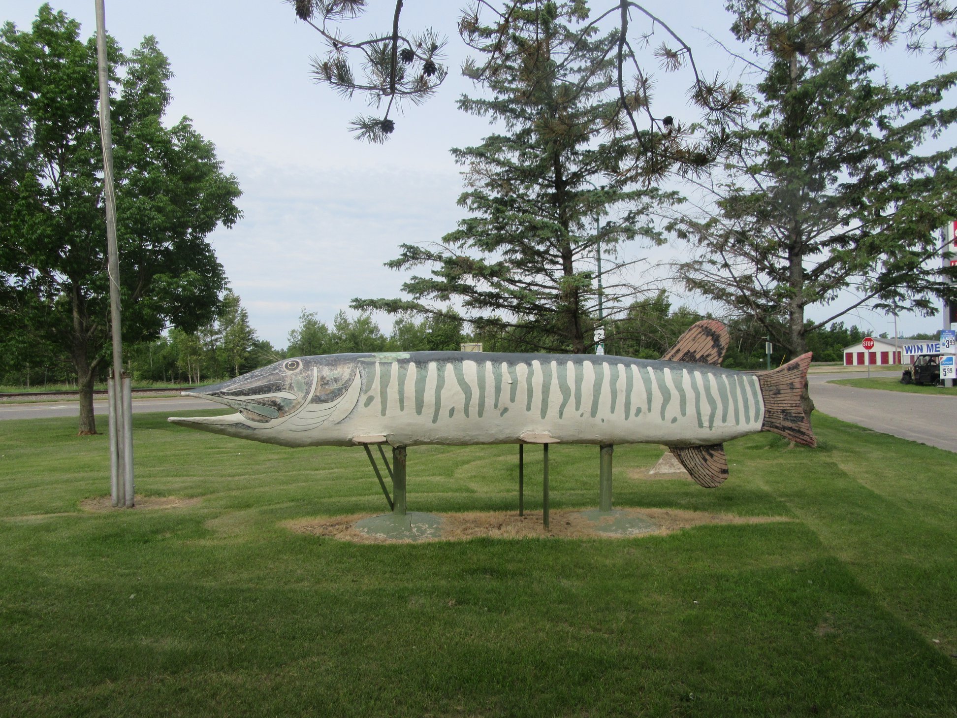
We left Grand Rapids, Minnesota, today in gray, overcast weather.  Our first stop was Deer River a town that "roadside attractions" told us would have a giant statue of a northern pike.  We even knew that this supposedly large fish was supposed to be at the intersection of highway 2 and "Division Street." We circled that town three times.  Finally, giving up, we turned up Highway 6 and lo, and behold! Highway 6 WAS DIVISION STREET.  We found our fish (which, for reasons of goofy driver syndrome, I called a 'duck' and several other animals instead of fish.)

giant statue of norther pike (fish) in Deer River, MN

Because the only thing we had to do today was get from Grand Rapids to Bemidji, we decided to do a lot of scenic touring.  Shawn had picked up a brochure in the National Forrest Center on highway 38 near Marcell. It advertised a "self-guided auto tour" of the Chippewa National Forrest. The directions take you in a loop from Highway 38, down a few county roads, and then some very narrow forrest roads. It was TOTALLY WORTH IT.  

For one, all of the "spots of interest" were extremely well marked. Our first stop promised wildlife, and it actually delivered. Not only did we see a beaver swimming in the pond (our fifth of this trip), but we also saw four ducklings making their way back to their parent.  On the other side of the road was reported to be an osprey nest.

It was there... complete with osprey.

osprey nest with nesting osprey

All the stops were fairly interesting, but I think my family's second favorite part was when we turned down a section of Forrest Road 2182 (the brochure warned: "this road is narrow. Proceed with caution" and they weren't kidding!). The location site was entitled "Tunnel of Trees" and it was really quite amazing. At several points we were driving under a dark canopy. The road was so narrow that it took us over a plank bridge that was really not much more than a few planks set at tire width.  VERY NARROW. 

My family likes to say "Might be worth a detour!" and this one really was.

The next place we headed towards was an area called "The Lost 40" because it really was lost at one point. A surveyor back in 1882 flaked. He and his crew left this section of woods off the map. They accidentally plotted "Coddington Lake nearly one half mile northwest of its actual location," and thus, when it came time for logging companies to divvy up the land, they missed 144 acres of virgin pine.  These are some of the oldest white and red pine trees in Minnesota.

There was another self-guided trail, this one a walking trail, for the Lost 40. Since we had such good luck with the scenic byway, we marched into the woods with confidence.

It was spectacular.

A long shot up a very, very tall pine tree.

We also took the classic shot--hugging the ancient tree, to show how thick the trunk of some of the trees in this forest were.

My family of tree huggers hugging an ancient pine

Then we got terribly lost.  There were large informational markers on the trail, but the trail itself was not terribly well marked. This is somewhat problematic as pine forests (as you can see from the picture of my tree huggers) tends to be barren and thanks to the pine needles. But, we only went off-course a bit, accidentally going to the trail's end at Moose River. We were able to turn back and reconnect with the walk... but my "indoorsy" family was getting hot and sweaty.  The weather was cool, but we had our hoods up on our hoodies to try to mitigate a very serious mosquito situation.  At one point, when it looked like our informational markers were out of order, Shawn let out a disparaging sigh and said, "Okay, but if we're going in the wrong direction, you will have to CARRY me out of this forrest, because I am DONE."

But, did I mention how gorgeous it was?

It was really f*cking gorgeous.

Mason's red hoodie as a stark contrast to the massive stands of pines

After this, we probably should have headed directly to Bemidji, but we had planned to eat lunch in Blackduck, Minnesota.  Before we left the wifi at the Grand Rapids hotel, Shawn had found us a diner that looked pretty good. It was actually fairly amazing. It was Restaurant 71 in Blackduck and I don't know if it was so good because we were all so exhausted, but I may never have EVER had a better California burger in my ENTIRE LIFETIME.

We also took a picture of one of the two black ducks in Blackduck, MN, because we are totally the people who take pictures of all the cheesy statues.

A black duck statue in Blackduck, MN

We tried another scenic byway, this one called "Lady Slipper Scenic Byway."  A lot of our byways have been under construction this trip. As I told my friend Dorian on Facebook, it's the old Minnesota joke: "there are two seasons in Minnesota: winter and road construction."  The ranger at the information center told me that, despite the gravel bits, the road was open. It was, though, what she neglected to mention was that a lot of the "sites" were actually fairly far drives from the actual scenic byway. I had given up doing a bog walk on our earlier Chippewa Forrest scenic byway, because I was more hopeful that the bog walk advertised as part of the Webster Lake Campground would have showy lady slippers, which is a flower I have never seen in the wild.

But, WOW did we get lost trying to find Webster Lake Campground. It was here that Mason poked his head up and wondered, "Why are we on a dirt road AGAIN?"

We ended up having to abandon our search for that bog walk, but a few clicks down the road we saw a pull-out that said it was a "Lady Slipper Interpretative Site."

There was a tiny boardwalk there, but the lady slippers were fairly amazing.

lady slippers growing wild

I don't seem to have much luck with bog walks. We're spending a day here in Bemidji and Shawn found me a brochure advertising a bog walk in Bemidji State Park. We'll see if I actually make it there tomorrow.  The big thing we want to be sure to do is hit the Mississippi headwaters in Itasca State Park, but other than that we've got no plans. 

After that, we head home to see if the kitties are still alive and if the house is still standing (pretty sure our cat sitter, Mr. Murphy, is doing a great job, but you know how you worry when you've been gone a long time.)

So far, it's been a wonderful vacation. There has been, as Mason has said, a lot of "looking at trees," but they have been very good trees, indeed.
lydamorehouse: (Default)
Just as we had on the way up, we made the trip home an adventure all its own. I was in full-on lavender-dad mode* -- including making us make a few u-turns when we missed our turn-offs. However, with one exception all our side trips were worth it.

The first stop was a short jaunt up Highway 1 off 61 to see Illgen Falls, made slightly longer by the fact that our guide book 61 GEMS ON HIGHWAY 61 noted we were to turn left just after the sign that read “Devil’s Rock,” but neglected to mention that the sign was _tiny_ and really easy to miss. We sailed right by it, but luckily the book also said we were to have seen it after only 1.5 miles. Even though I hadn’t watched my odometer, it was clear we’d gone much further since we entered Finland (the town, not the country, but cue jokes about being REALLY lost right about now.)

Shawn “Eagle Eye” Rounds spotted the tiny marker the second time we passed it and another set of u-turns got us into the pull-off. We had a brief argument about whether or not we could actually park in the no parking spot by the locked fence marked “State Park.” But Shawn suggested, and I think rightly so, that the pull-out was a better spot. It was clearly the right choice when we noticed the trail right next to where we finally parked.

The guide book promised that the trail was narrow and steep, but short. Turns out they weren’t kidding about the steep part. If we hadn’t come to a set of man-made stairs, I would have believed that the whole thing was just a deer trail that people had used on occasion. The trail got us out at the top of the falls.


A bit of scrambling, and we got the money shot. The best part was that the guide book was right. It was impressive as hell. The picture they shot was during a drought, so I wasn’t prepared for this:


Satisfied that the little spat of arguing and getting lost was totally worth it, we all climbed back into the car and set off for our next destination, Iona’s Beach. The reason I wanted to see this beach is because the book said that if, conditions were right, the sound of the waves hitting this unique shoreline of flat, shingle-like “pink rhyolite and felsite bedrock” makes a tinkling, bell-like sound. It’s also designated a scientific research area, which just added a whole extra level of potential awesome, I thought.

Here, the guide book out and out LIED. It said that turn off to the beach was clearly marked near mile marker 42. We zoomed past mile marker 42 because all that was well marked was a sign saying “public water access” which is a dime a dozen along the North Shore Drive. We made yet another u-turn and pulled into the lot, where more confusion set in. We parked. We looked over at a beach and a breakwall. The beach was clearly marked, “Private Property, Enter at Your Own Risk.” Hmmm, not the friendly, inviting beach the guide book suggested we’d see. Plus, it was decidedly not pink, which was supposed to be one of the more striking features of Iona’s Beach.

We looked around. There was a path leading north, and Shawn remembered reading something about a short hike to the beach. Okay, what the hell, we thought. After all, Illgen Falls seemed hard to find, but had panned out as well worth the hassle.

A short walk revealed a rather stunning beach. There was a rock formation that looked, well, fake, and Shawn suggested that it might be lava flow (which we knew from our other reading was a definite possibility along the North Shore.) This, however, still didn’t seem right. Could this be Iona’s Beach? Where were the pink rocks? The magical sound of the waves hitting rock? This was a seriously awesome beach, but I wasn’t convinced this was Iona’s.


Shawn and Mason were quite content to explore. I was, as previously mentioned, in Adventure Mode, and so was on a quest to find THE BEACH (fill in “lavender farm” or other ridiculous sounding destination.) I noticed that the path continued, and that there appeared to be a sign post at the top of the nearby cliff. I yelled that I was off to investigate. Sure enough, here, quite a distance from the pull off was the “well marked” sign indicating that just beyond was the famed Iona’s Beach.

It’s definitely weird. I’ve never seen a beach quite like it, what with gigantic dunes of perfectly flat blue, green and pink stones. But, was it worth the hassle of discovery? Iffy. When Shawn and Mason joined me, Mason enjoyed tossing the rocks back into the water, but the lake couldn’t have been more glassy and still, so there was no tinkling or magical bell-like sound to hear. But, we also explored a nearby cavern carved by the waves, which, when we tossed rocks down it, made a FANTASTIC splooshing sound. In the end, as Shawn noted later in the car, the first beach was way more interesting. Iona’s Beach seemed desolate and alien in comparison.


Our next big destination was food. When we finally stopped at a fast food joint and filled up the car at the gas station, I remarked that we’d gone approximately 100 miles in four hours. And, we skipped stopping at Flood Bay again, though very regretfully. We’re going to make that part of our annual trip, however. Unsuccessful agate hunting is much more fun for us, and, really, a bit more Mai Tai,* as it’s very relaxing.

With all the driving and side-trips, I was exhausted by the time we got home. I’ve been slowly recovering ever since. The time at the lake was very relaxing, but I need a vacation from the drive back! I don’t regret making the stops along the way, but I think it was more fun on the way up because once we got to the cabin, it was relaxation time. On the way home, we came back to unpacking, unopened mail, etc., etc.

I can’t wait to do it all again next year. We already booked our cabin for next season.

------------
*see earlier post (part 2) for explanation.
lydamorehouse: (Default)
I'm writing to you from the Bearskin Lodge just off the Gunflint Trail, not far from the start of the BWCA (Boundary Waters Canoe Area, for those non-Minnesotans who might be reading.) We've decided to extend our stay here another day, so I won't be back to blog about life, the universe, and everything until Wednesday.

Despite what you see before you, internet does not come easily here. It's a short hike to the main lodge, but I'm not planning on sitting here when I could be out there with the pristine lake, moose, and more.

See you when we get back!

May 2025

S M T W T F S
    1 23
4 56 78910
111213 14151617
181920 21 22 2324
25262728293031

Syndicate

RSS Atom

Most Popular Tags

Style Credit

Expand Cut Tags

No cut tags
Page generated May. 30th, 2025 05:18 pm
Powered by Dreamwidth Studios
OSZAR »