lydamorehouse: (Default)
2022-09-19 02:30 pm

New Cat, Who Dis?

 new, as yet unnamed kitteh
New, as of yet unnamed kitteh, a stray who looks IDENTICAL to Willow, aka The Void.

This weekend we heard a lot of howling and yowling in our yard. Upon investigation, we found this young lady (guessing no more than 6 months old) entertaining a bevvy of gentlemen callers in our backyard. We were able to coax her onto our porch for safe keeping as we hit the usual Facebook groups for an owner. No hits so far, though there is at least one person who is interested if she will otherwise be homeless. We have a vet appointment scheduled for her to get her emergency tests: feline leukemia and intestinal parasites, etc. If she gets along with our other two, we will get her on the docket for a spay. 

Otherwise, perhaps, some lucky neighborhood Facebooker will get a new cat.

We are trying to resist naming her, but the vet needed something so she is currently, Clover, as in we found you rollin' in the...  Mason pointed out that if we keep that name, all of our current crop of cats have botanical names: Willow, Buttercup and now.... clover? We shall see. We are trying to be responsible here, since our current couple get along famously and we have been loathe to break up their perfect union. 

In other news, there's been a flurry of activity around my place. Monday and Tuesday, [personal profile] naomikritzer and I played tour guide (not to be mistaken for The Tour Guide) for two out-of-town guests, [personal profile] rachelmanija and her friend Lauren, who were here for Bouchercon, the world mystery convention. I started them off at Axman, a local "surplus" store that is far, far more than your average surplus. We're talking about surplus iron lungs, buckets of dolls heads, and so much weird stuff... along with lots of dead-useful electronics, etc. It's kind of a place that needs to be seen to be believed. 

Then we had lunch at Se Salt, with the intention that maybe we might take a look at Minnehaha Falls. Normally, you can hear it roaring from the restaurant. I didn't hear it, but also didn't think of it... until we looked over the edge. There was barely a trickle. I'd forgotten about the summer long drought, despite my constant struggle to keep my garden alive. It didn't seem worth doing a nature hike, so we ended up on Summit Avenue. I gave everybody a walking tour, which was a great deal of fun. We walked a LOT, but it was a lovely day and the buildings are so fascinating. 

Rachel was around a second day so we did some books shopping and hanging out. 

And then on Thursday offcntr and Denise came to town as well. We went out to lunch at Bole, an Ethiopian restaurant. They have an amazing outdoor patio because Bole was one of the places that burned to the ground here in Midway during the George Floyd riots and, thus, they relocated during the pandemic. We had a lovely time just chatting and catching up and eating amazing food.

The rest of the week and weekend were spent finishing painting our bedroom. We'd painted one wall Baskerville Blue, if you recall from an earlier post, and we hadn't gotten around to doing much else even though we wanted to make the other three (we have five walls in that room) a lighter, yet rich yellow. We finally finished that project this weekend, though it took me both days thanks to the kitten dropping herself into our lives.  I would post pictures of the bedroom, but it is actually so dark in that room, I'm not sure if a photo will do it justice. 

Hope you all had a good week. Sorry I was completely absent.
lydamorehouse: (ichigo hot)
2022-05-15 08:53 pm

There, And Now Back Again...

I had been most looking forward to today. We had Mason with us and the on stop I was SURE we would all deeply enjoy was Centralia, Pennsylvania. If you know this town at all, it's probably through the video game "Silent Hill," which took the idea of what happened in real life Centralia and expanded it. So what happened in real life? A garbage fire ended up igniting a coal vein... the ground underneath the town has been burning ever since. It will apparently burn for many, many more years yet before the coal is depleted.

There wasn't much to take pictures of, thought I did snag one of the Orthodox Church that stands watch over the remains of the town.

The church near Centralia
The Centralia Orthodox Church.

But, there really is almost nothing to see. A couple of years ago, someone covered "graffiti road" with dirt, probably to discourage tourists like me and my family: https://allthatsinteresting.com/centralia-pa

Plus, my family and I probably should have eaten before we tried to find Centralia. We get notoriously bitchy if we don't eat by a time, and we missed an opportunity to grab a sandwich and so by the sixth time that I was turning around on a tiny, narrow highway there may have been some yelling... which was not at all how I wanted this particular leg of the trip to be. I had really hoped we'd get out of the car and wander around, but we ended up turning around so many times that by the time we ran into some other people on one of the side road who were also exploring the ex-town, we were all so fried that we never even got out to stretch our legs.

:-(

But, we made up for it by finding a spectacular waterfall outside of Clarion, PA, called Rapp Run Falls

Rapp Run Falls
Image: The falls

Rapp Run
Image: Rapp Run River, looking like something out of Middle Earth

The other thing that amused us today were the Pennsylvania mile markers. Apparently, they mark every tenth of a mile and they have never heard of reducing factions, so there were 1/10, 2/10 (instead of 1/5), 3/10, 4/10 (instead of 2/5ths) and the one that drove me insane, 5/10th... I mean, okay, for consistency I get maybe doing everything else as tenths, but why not mark the half mile as HALF MILE?? 

Can you tell we were pretty bored of driving?


It was a long day, but we are safely back in Youngstown, OH again. Having liked out hotel so much the first time around, we simply booked it again for the return trip.

lydamorehouse: (Default)
2022-05-14 08:49 pm

Our Own Personal Slice of Heaven (and Lobster Rolls)

 the book barn
Image: The Book Barn in Niantic, CT

The Book Barn in Niantic was pretty much everything I ever wanted from a used bookstore. They even had cats (and goats.) I mean, I will admit that I kind of hate driving in New England because the streets are narrow and if the speed limit is posted at 35, all the drivers read that backwards and drive 53 and THEN also slam on their breaks when they need to make a sudden turn. It's terrifying. However, it was worth the harrowing driving to make our way EAST to Niantic, CT to see the many versions of the Book Barn. We stopped in downtown first because it was where the science fiction was located (as well as the other genre books) and then we headed to the main sight, which is kind of a book wonderland.

book barn 2
Image: yet another barn/outbuilding with books in it

gargoyle
Image: a secret garden at the Book Barn (complete with koi pond.)

"Barn" Cat
Image: "Barn" cat on the pavement. The Book Barn has five (?) cats. We saw three.

troublemakers
Image: book section reads, "Radicals, Anarchists, and Other Troublemakers."

We spent several hours here before driving a little further down the coast to a restaurant called "Skippy's" where Shawn had heard they had good lobster rolls. Lobster rolls are one of those legendary things that Shawn had been reading about forever and really, really wanted to try. In fact, her great regret last time we made it out to Connecticut to drop Mason off in the fall was that we never stopped to have one. So, this time, we came prepare. She'd read up on the places to go and the fact that Connecticut lobster rolls are special. In Connecticut you have lobster rolls hot, slathered in hot butter, on a toasted bun. Apparently, (she says uncertainly, as she is a Midwesterner bred and born,) other places lobster rolls are served cold, with mayo. 

But, we really enjoyed the Connecticut version!.


A lobster roll, sweet potato fries, and coleslaw
Image: A lobster roll, sweet potato fries, and coleslaw

MMMMMMM, so good!  I am determined to try the cold version at some point, but I am unsure how anything can compare.

Our last stop was Hammonasset Beach State Park. Shawn and I had been there before, but this was Mason's first time. He's seen the Atlantic before, but I'm not sure he'd dipped his toes into it before. Those of you who have not been following me for very long may not know that my son used to dream of being a marine biologist. He got the ocean bug, I think, by watching Blue Planet as a small, but it is honestly stuff like this that make me believe in past lives. There are so many stories I could tell on this child, but just know this--this is the young person who, at the age of six, came running down to the landing when he was supposed to be asleep wailing so much that I thought he must have injured himself saying, "Mama, Ima, mama, ima!" (I am ima, Shawn is mama,) and when I ran to comfort him, he wept into my arms, "Mama, ima, megalodon is extinct!" 

I was only able to comfort him by saying that while, yes, this was true, there were still a lot of smaller sharks still around. 

So, he LOVES the ocean.

Thus, I was surprised when Mason was initially kind of meh about the beach. I suspect some of it had to do with the fact that it was bit crowded. There were a ton of people at the beach, despite the overcast day and fog. Mason likes his alone time with nature. But, some people started shouting about jellyfish and so I went to look and managed to coax him into the water. After seeing the jellyfish floating in the surf as well as spotting a hermit crab shuffling long on the ocean floor, he got into it.

Mason inspecting the shallows
Image: Mason inspecting the shallows for signs of marine life

I had a lot of encounters with sea life, myself. I am often nibbled on when I go to lakes by sunfish and the like, but I did not expect to also be tasty to whatever small fry hang around near the shorelines of the ocean!  But I got nipped by some small fish that I could see, plus a little ghost shrimp briefly landed on my foot as I was leaving for the shore (I shook the little guy back into the water safely.) 

We ended up having quite a lot of fun despite the weather. 

Then we drove a few miles and checked into out hotel. Time to settle in with a few of the many books we bought at the Book Barn!  'Night all!
lydamorehouse: (Default)
2022-05-12 07:58 pm

Road Trip (Day 3)

 Freedom falls in Venango County, Pennsylvania
Image: Freedom falls in Venango County, Pennsylvania

We woke up this morning in Youngston, Ohio and ate terrible hotel food in our room. I mean, "terrible" might be strong. It was just hotel breakfast food, which I'm sure as soon as I say that, you can imagine what I mean. We are trying to wear masks in public spaces, so even though a lot of people were using the dining room, we did not. 

Since we did not have very far to go today, we decided to plan a couple of detours. The first one was to Freedom Falls. We were looking for things that were just off I-80--or at least not too far off--and Shawn found this falls that was on the Shull River. For some reason, her GPS does not deal well with any location that doesn't have an actual address. We were able to plug in the very vague description of "Freedom Falls, Shull Run, PA" into *my* phone and suddenly we were underway.

I will say that my phone also liked taking us down roads that were unpaved, gravel and named "Blair Road" which we re-named "Blair Witch Road" due to its scariness. 

However, it also delivered this amazing location. I was really uncertain though when the lady in the GPS announced, "Your destination is on the right" and then turned herself off when we are on a STEEP dirt road. We were able to turn around at the bottom of the road and then go back to where she suggested the falls were and pull into a pullout. Uncertain, Shawn and I got out and.. sure enough, we could hear the distinctive roar of a waterfall. I noticed an obvious trail, which we were able to follow down towards the river where we found the falls. 

I was impressed, both with the falls and my GPS!

Then we got back on the road feeling like we had already had a pretty grand adventure and we really didn't need a lot more to be satisfied. And, I'm a very funny traveler, if I get a nice "destination" out of the travel, I'll pretty much go all day. So, we took a couple of more detours. The next was not as successful as the falls. We found a roadside attraction called Doolittle Station in DuBois PA.

The weirdness that is Doolittle Station
Image: The weirdness that is Doolittle Station

I'm not sure what madness of consumerism overkill decided that a collection of railroad boxcars also need DINOSAURS (and Bigfoot,) but it is delightfully kitschy. 

Shawn was less convinced than I was, but we both agreed that the food at the creamery was actually quite good. 

From DuBois, we headed back onto I-80. The last thing that we really wanted to experience was a covered bridge, since Pennsylvania is known for its Amish settlers. So, we turned off near Loganton, PA and managed to use my miraculous GPS by plugging in "covered bridge near Loganton" and we not only found the bridge, but also a small Amish community!

Amish farmer on a horse-driven plow
Image: Amish farmer on a horse-driven plow

covered bridge
Covered bridge!

We have made it as far as the border of New York State, so I am going to once again collapse into the hotel bed and sleep!

I hear the Twin Cities got a little rain. I hope you are all doing okay!
lydamorehouse: (crazy eyed Renji)
2022-05-11 08:16 pm

Real Life (tm) Travel

 Marblehead Lighthouse
Image: Marblehead Lighthouse on the shores of Lake Eerie

Given how often I post pictures of virtual tours, I should probably be very clear. I WAS ACTUALLY HERE. Shawn and I decided to take a little side trip while in Ohio, and so we stopped at Marblehead Lighthouse. This is the oldest lighthouse in continuous operation on the US side of the Great Lakes. It is in a town named after it in Ohio, and it is on the shores of Lake Erie.

Lake Eerie
Lake Erie

My family has a motto for our road trips, which is: "Might be worth a detour!" and so we are always up for stopping at slightly out of the way places to see what might be seen. I have to say, the lighthouse was lovely. Normally, you are able to go inside the lighthouse, but by chance, their open season doesn't begin until after Memorial Day, so it was closed. Even so, the rocks around the peninsula were lovely and seemed to include a number of fossils. They reminded me of the lava flows around Lake Superior. 

Tomorrow, we head into Pennsylvania and I've been tasked with the job of finding out if there is anything along I-80 that might be worth a detour. I think I have found a couple of possibilities. If we stop anywhere nifty, I will post whatever we see tomorrow night. 

My brain is fried from all the hours n the road, so I will keep it short tonight. 

lydamorehouse: (ichigo irritated)
2021-10-18 07:52 am

Trip to Frontenac

 A colorful fallen oak leaf
A colorful fallen oak leaf.

On Sunday, Shawn and I decided that we wanted to go see if we could catch some fall color before it faded completely. The MN DNR color tracker told us that just south of us was at peak or just past, so we decided to take a trip down to Frontenac State Park. Frontenac State Park is just between Red Wing, Minnesota and a natural widening of the Mississippi called Lake Pepin. I have never understood, despite growing up in this area, what makes Lake Pepin a "lake." I tend to think of lakes as bodies of water that are, you know, separate from a river, or at least much, much larger than the river that feeds it? But, somehow this fat section of the Mississippi gets to technically be a lake. 

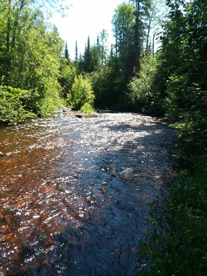
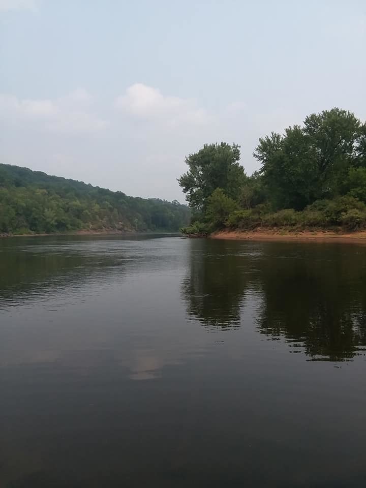
No matter how you define it, the view is gorgeous:

The view of the Mississippi from the top of the bluff near Frontenac.
Image: the view atop the Frontenac State Park bluff towards Lake Pepin/the Mississippi River

Before leaving for the State Park, Shawn and I did a bit of reading in all the various books that we've collected on Minnesota state parks over the years. One of them recommended the self-guided interpretive trail and so we planned to walk that, as well as maybe the pine circle trail. I also really wanted to see the rock with a hole in it, called In-Yan-Teopa. 

We decided to drive down in our new-to-us Toyota, in order to test drive it. We are, for the first time in our lives, a two car family. There is a used car shortage and so we actually got this second car in order to hold in reserve for when our current Ford dies. I'm glad we test drove it because there was some concerning creaking that I'm going to have our mechanic look at when I take it in on Thursday, but we kind of forgot that our state park pass was actually affixed to the window of our OTHER car. So, when we got to the park, we had to stop in and get a day pass. Shawn managed to find a sweatshirt and several other things, so it was worthwhile. Plus, the ranger who was staffing the front desk was very helpful. She stamped my passport and gave us a great overview of places where we might see some good fall color.  She had just hiked everything in the last couple of days herself. 

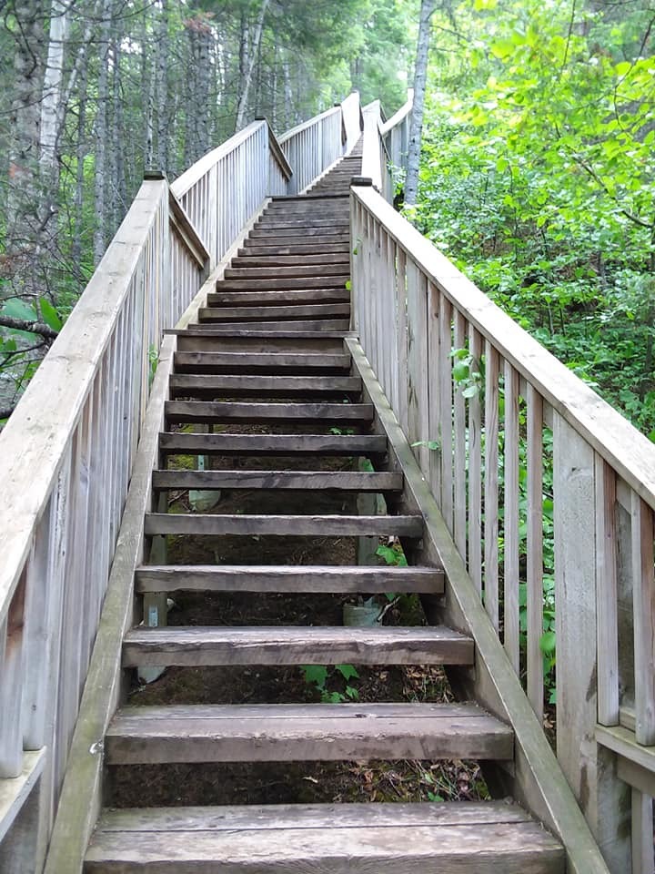
She did also warn us, like all the books did, that there was "some elevation." I have come to understand that "some elevation" is the geological equivalent of "some weather." When Minnesotans tell you there's been some weather recently they don't mean a bit of rain, they mean a tornado ripped through yesterday. I now know that when a Minnesota park ranger tells you there is "some elevation," she means HOLY SH*T YOUR KNEES WILL KILL YOU CLIMBING ALL THOSE F*CKING STAIRS.

A blurry shot of stairs ascending the bluff
A blurry shot of stairs ascending the bluff.


But, so, Shawn and I took the interpretive hike, which did not have a huge amount of signage. But, it led to the lovely, flat pine circle trail which we enjoyed. It was very much Shawn's speed as it was a loop, had benches at every turn, and was under a mile. The hike back up to the picnic area, however, was where we first encountered "some elevation." This set of stairs was just one of MANY. We did get to hike along the old quarry site, which was fascinating, and there was an iron ring still pounded into the ground where a rock was going to be taken but was abandoned for some reason. 

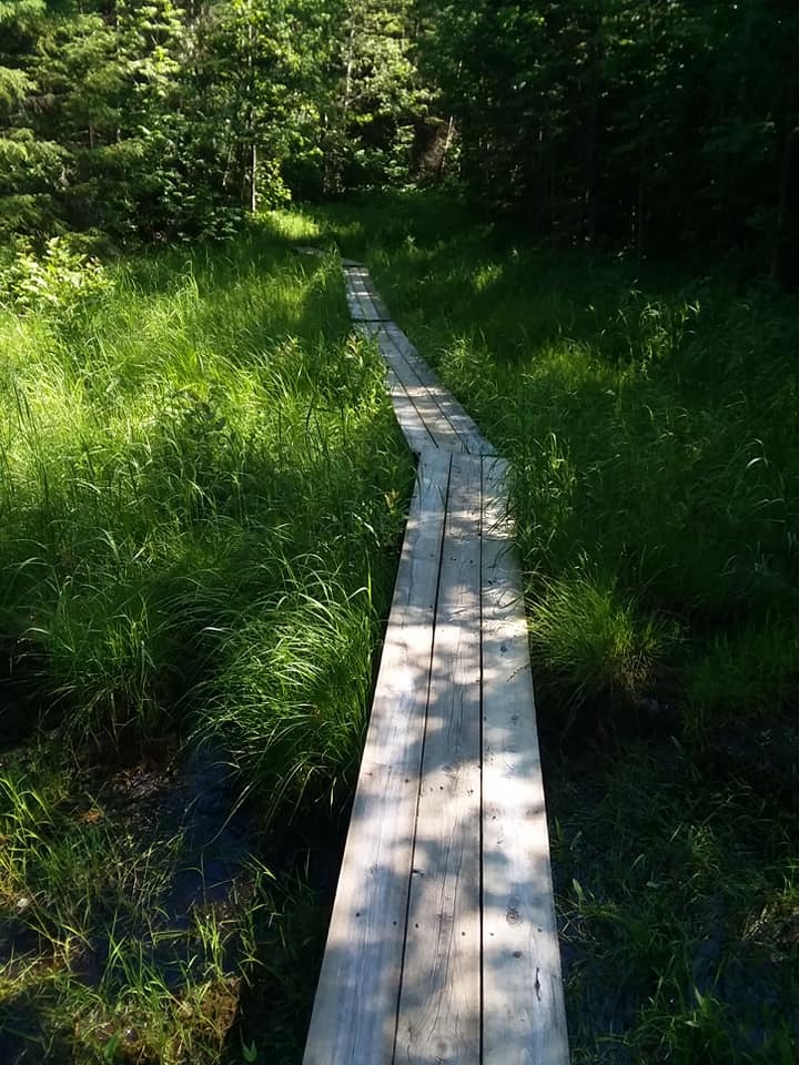
At this point, even though we arrived fairly early (an hour or so after the park opened at 8 am), we started to encounter a lot of other hikers on the narrow trails. The trails were so narrow that we had to press up against the rock face in order to let people pass. 

The steep path along the bluff in Frontenac
This path is actually not as narrow as some, but you can see how there is just a wooden plank bridge over some areas. Now imagine that, only with the other side being a rock cliff.

The weather could not have been more perfect, however. We did see a bit of fall color here and there, too.

sunlight through yellow leaves
image: sunlight through yellows leaves

After the steep interpretive trail, Shawn tapped out. As she said several times during our walk, "Do not mistake me for a hiker," and so I left her at the picnic area with a good book (the newest Longmire) and waved goodbye as I headed off to see the rock. 

A good portion of the way out towards the rock was paved and perfectly flat. I missed a turn, however, and ended up tromping through the very busy campground (people were packing up to leave) until I found my way back to the upper bluff trail. That trail was slightly more rigorous, if only because the ground was uneven and the path narrowed significantly again. I got excited when I started to see signs for the rock...


a sign!
image: a sign!!

But, I was disappointed by what I saw when I got to the observation area....

Yep, the uninteresting top of a rocky outcropping....
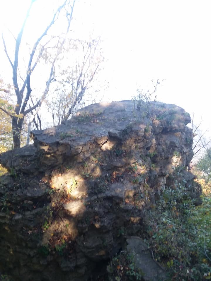
image: Yep, the uninteresting top of a rocky outcropping....

As I was staring at this very dull rock for several minutes a couple of other hikers came up and explained to me that if I wanted the view of the actual stone arch, I would have to hike down to the lower bluff trail. The ranger had been actually very clear (for a Minnesotan) that the lower bluff trail was steep "but do-able." Given that all we got for the stairs that nearly killed us was "some elevation," I figured this warning should be headed. Also, I was on my own. Shawn was waiting patiently in the picnic area, but it was after one o'clock and I still had to make my way all the way back to her. I decided that this was the view I was going to get. 

I did look it up, however, so if you're curious what I WOULD have seen, this is it::

the view I should have gotten
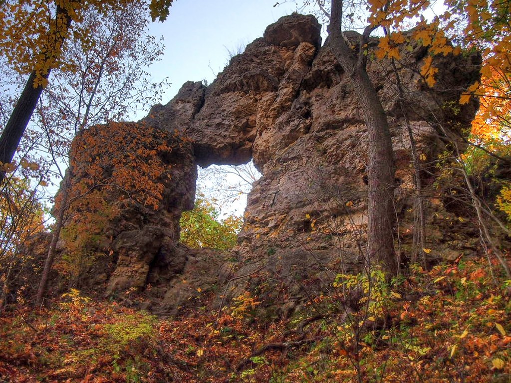
Image. the view I should have gotten. (Yanked from the wikipedia entry on Frontenac State Park.) https://en.wikipedia.org/wiki/Frontenac_State_Park

We spend a good portion of our day on this little trip and it was very fun, though my knees ache a little today?  The ironic thing, of course, is that for all that walking not a mile of it counted for the Minnesota Hiking Club, because I never walked the official trail to get the password. At some point I will have to come back to log those miles, but not any time soon. Maybe I'll walk it next spring. 

Shawn brought along her old film camera, so it should be interesting to see if any of her pictures turn out. Also, as we were leaving we caught sight of trumpeter swans in the Mississippi. So, that was very nifty.

All and all, a thumbs up.

lydamorehouse: (Default)
2021-10-11 08:24 am

Long Time, No See

Last week was really quite busy, and I failed to report any of it. Let me see what I can reconstruct from my memory.  

Last Monday, the big excitement was getting my Pfizer booster shot (along with the flu shot in the other arm.) Very unexpectedly, I got a strong reaction... kind of for the first time. I had a headache, muscle aches, chills, and a fever. While I was lying in bed complaining about the fact that no one warned me that this one could be tough, Shawn looked it up and the reason no one did is because only about 11% of people who get the booster have any sort of reaction at all, much less all of this. I had a bad roll of the dice.  However, like with previous doses, I tend to like having a strong reaction because then I know I got the shot? 

So, that wiped me out for a lot of Tuesday, too. 

I had my Loft class on Wednesday. My Loft class is going very well, I think. Though, I am a bit more disorganized this time than I normally am. I don't know why? My brain is fickle, I guess.  Plus, I started out with seven students and am now down to six.  I had a student in California who seemed to be under the impression that "workshopping" meant something a bit more like what you'd get from a writing coach, rather than rigorous critique. So that person was disappointed and bailed, which, you know happens from time to time. But, I do think that eroded my usual confidence a bit. 

On Wednesday night a friend came to deliver a new-to-us used car, which also sent my household into a small amount of decision anxiety. There is a used car shortage coming/happening, and so Shawn and I would like to be on top of that, since we only ever buy used cars. So, when our friends offered this one--a 2011 Toyota Camry--we were like, "yes, yes, YES!" but we hadn't previously thought through all the logistics. Where will we store it? How much will insurance cost? Should we immediately sell the older car? Or? Or....???  So, we had to work all that out, and, of course, do all the title transferring, etc. We are very happy with the results. 

Since we had part of the day before our friend had a flight back to Michigan, she wanted to see the Minneapolis Institute of Arts. Normally, when she and her family visit, it's Thanksgiving, so a lot of the usual things are closed. I am always up for a trip to the MIA, so we went. We diverged early, her heading off to explore the third floor, and me revisiting the Chinese and Japanese collections. Since I've been recently reading The Grandmaster of Demonic Cultivation / Mo Dao Shi Zu,  I rather enjoyed pretending I was on the set of the live-action version "The Untamed," while checking out this "Chinese scholar's study" at MIA: https://new.artsmia.org/programs/teachers-and-students/teaching-the-arts/artwork-in-focus/chinese-scholars-study/

A recreated study from Chinese antiquity

I hardly left this area the entire time I was there, because next door to Chinese antiquity, is the Japanese collection. I ended up live-tweeting (actually Discording) with a friend in Wales about the various cool objects we came across. 

For instance, I sent her this picture because we are both fans of Bleach and I said that I thought this was the kind of costuming worthy of the mangaka of that manga. Like, it looked like it should have a magical name and a super-power, possibly a personality.

A type of samurai headress./helmet called Kawari Kabuto, 17th century
Image: Dragonfly helmet, 17th century, Japan.

And because we were chatting back and forth, live, my friend in Wales was looking up information on this type of helmet, which is called kawari kabuto, or "strange helmet," which was apparently popular in the Momoyama Period to distinguish leaders or to give a battalion a symbolic motif. Some parts of the helmet are iron, but the fancy bits were made with lacquer over papier-mache. If you're curious about other designs, someone has a lovely Pinterst page that shows off a number of others: https://www.pinterest.com/dan_stiver/kawari-kabuto/

I
 also spent a long time in the calligraphy rooms, because I am/was a fan of an anime/manga called Barakamon, which is about a disgraced calligrapher trying to make his way back into the art world. 

Just I was leaving, I stumbled into the collection of anarchist zines. The Minneapolis Institute of Art recently acquired the Fly Zone Archive,https://new.artsmia.org/stories/rebel-voice-inside-the-fly-zine-archive-a-chronicle-of-punk-queer-and-diy-counterculture

Thursday night, I also had Wyrdsmiths, my writers group, which is still meeting via Zoom. We caught up with a member that has been on hiatus for some time, so that was very pleasant. 

The weekend was a lot of car stuff--Shawn wanted to take the new-to-us car to get the special cleaning treatment at a Mr. Car Wash--and we put on the new license plates, etc., etc.  We also had a movie night, where we re-watched Dr. Strange, and ate too much popcorn. On Sunday, yesterday, we spontaneously took another trip to Fort Snelling State Park. 

Even though I had walked Pike Island before, I had never officially logged my miles for the Minnesota Hiking Club, so we did the whole thing, collected the password and... saw this amazing white pelican preening itself on the backs of the Minnesota River.

A white pelican preening itself on the banks of the Minnesota River.

This week, my plans include prepping for Wednesday class, and hopefully not too much else. It would be nice to have more time to write this week, as I'm starting to feel a bit behind. 
lydamorehouse: (ichigo freaked)
2021-09-27 10:58 am

Saturday Strolls and More...

 The view of Minnesota Lock and Dam #1 (Mississippi River) from the Minnehaha Dog Park.
Image: The view of Minnesota Lock and Dam #1 (Mississippi River) from the Minnehaha Dog Park.

I went walking with some friends of mine early Saturday morning at the Minnehaha Dog Park. Not having a dog myself, I had only ever been there as a visitor once or twice before. It's actually quite lovely, if you are cool with random doggos bounding up to you on occasion to check you out (which I more than am.) 

The sky-blue asters were blooming.
A flower growing on the banks of the Mississippi that I initially thought was a fleasbane, but is actually called sky-blue aster.
Image: A flower growing on the banks of the Mississippi that I initially thought was called fleabane, but is actually "sky-blue aster."

To be fair to me, fleabane is in the aster family, and t's kind of a shame that these aren't fleabane, because fleabane does (to some varying degree of efficacy, which is to say almost none) repel fleas. Obviously, whether or not it actually works, fleabane seems like the perfect flower/weed to encourage in a dog park, doesn't it?  But, these, I'm fairly certain, are actually sky-blue asters, so there you go. They were everywhere along the sandy banks of the Mississippi. One of the few natives in bloom in the dog park. 

Anyway, it was a lovely walk followed by donuts and coffee shared with new friends, whom Shawn and I met at a backyard concert held by the neighbors-across-the-street. Shawn declined to go on the hike with us, being far more "indoorsy.". She stayed home and finished up a few rugs on the loom. 

But, Shawn and I went for our own neighborhood stroll on Sunday. During the height of the heavy lockdown part of the pandemic, Shawn and I used to go on neighborhood walks in St. Paul regularly. I started photographing some of the cool architectural details / nifty houses that I came across, and I posted them on Facebook. I did the same on Sunday, which you can feel free to check out, if we are Facebook friends, otherwise I will simply share this one very TERRIFYING bit of sidewalk poetry that we came across. 

"She was steward
of the smallest things: pair of dead bees in the windowsill
Santa ring, cluster of elm seeds in their felted cells."

sidewalk poem

Shawn and I read this together silently and then I turned to Shawn and said, "IS SHE SATAN?? MAYBE A SERIAL KILLER??"

The weekend was otherwise quite lovely. I was stepping into a NPC role in my monthly RPG for a single session, so I spent an inordinate amount of time reviewing that character's interactions in the session logs so that I could do him justice. It was really valuable for a number of reasons, not the least of which I was reminded of "the story so far" much further back than I normally re-read since I wanted to follow him since his introduction. I can't speak for my fellow players, but I had an especially good time. It was kind of fun/illuminating to step into his point of view on all sorts of levels. 

We also got a chance to catch up with Mason on Saturday night for a brief Zoom call. He seems to be doing very well--getting involved in various clubs like the sustainable farm (run by a bunch of anarchists, apparently, who make every decision by consensus) and the Labor Socialists. So, you know, seeping in that bastion of left-wing politics, as required. :-) He's made several new friends, so I'm very proud of my extroverted introvert. Mason is the kind of introvert who isn't shy, per se, he just gets DONE with people after a certain amount of time and prefers to have is quiet time when he needs it by himself. He recharges alone, reading, etc. But, if pushed he can do public speaking, friend-making etc.  He told us that his strategy was to find a very extrovert friend who collected people and then he could hang out with all of the extrovert's friends and they would at least have her in common. Clever boy!

He also got a work study job in Wesleyan's library doing archival processing of government records, which is only funny because I have been an archival processor when I worked at the Minnesota Historical Society, and, of course, his mom/Shawn is the State Archivist of Minnesota who deals exclusively with government records. So, he knew all the lingo going in. 

So, that was gratifying to hear. He seems at least to be flapping furiously post being kicked out the nest and that is the very best one can hope for as a parent, IMHO.

The only other big news to report is that I've scheduled my COVID vaccine booster for next Monday. Once again, I must thank my fat ass for saving my ass. I would not qualify if the doctors didn't consider me obese. 
lydamorehouse: (nic & coffee)
2021-07-29 05:47 pm

Random Hike #1: Cannon Valley Trail

60 Hikes Within 60 Miles of Minneapolis/St. Paul


 I was feeling restless today, so I stuck my finger down on a random page in a new hiking book that Shawn bought me, 60 Hikes Within 60 Miles of Minneapolis/St. Paul.  The hike that fate picked for me was the Cannon Valley Trail. I decided to not even really read up on it, but just go. So, I plugged the name of it into my GPS and off I went. 

The drive down was really quite lovely. The Cannon Valley Trail is south of the Twin Cities and stretches between Cannon Falls and Red Wing. There is a halfway point, a way station at Welch, which is where the GPS figured I must have wanted to go. The GPS also thought there was a lot of construction and so I was wound around Hastings and down several county roads I'd never been to before. 

The way station at Welch had a lot of amenities, so far as I could tell, especially if you were on bicycle--which this trail was really designed for. 

A paved trail stretching out into the distance, It is surrounded on all sides by woodland.
Image: A paved trail stretching out into the distance, It is surrounded on all sides by woodland. (Leaves are on the ground because of the severe drought conditions.)

According to the hiking book, the trail was developed on a railroad bedway. On my walk, I passed on of the old rail mile markers for the old Chicago Great Western line (mile marker 83.). I was mostly alone on this stretch. Or, rather, my companions were only with me for a few seconds as they whizzed by on their bikes. I could tell that at least one biker was very confused why I was walking the trail as, after calling out hello and thanking me for having stepped off the path as soon as I heard his wheels behind me, he said, "Nice day for a... well, hike, I guess?" and I was like, "Yes?" 

So, it wasn't actually 100% congenial to the hiker.

That being said, I did find a few things to enjoy on my random hike. I mean, I'd feel bad about having picked a dud, but I really did just decide to go with the first thing my finger landed on. The trail from Welch follows a stretch of Cannon River on which I could hear inner tubers having the time of their lives. I was a little regretful that I didn't pack a swimsuit. I might have considered renting a tube, myself.

A view of Cannon River through the trees
Image: A view of Cannon River through the trees

Otherwise, the trail was straight and long and flat. As I have mentioned before, I am not against hikes that take you nowhere, but I am much more satisfied with a "destination" hike. I like to get to some sight or other and then turn around. As it was, I kind of felt like I was just marching along.  I did, at least, remember to stop and enjoy the flowers. There were several interesting flowers spotted on this hike. I've been noticing wild  purple bergamot all over and I caught a nice picture of a bumblebee inspecting a stand of them on this trail.

A bee clinging to the petals of a pinkish wild bergamont
 A bee clinging to the petals of a pinkish wild bergamot.

I probably shouldn't have hiked at all today, however. The air-quality is the worst it has been in decades, thanks to the Canadian wildfires. I am kind of tempted to try this again tomorrow, as Shawn has to go into work. I also have a planned outing with some new friends to finally officially do the Pike Island Hike for the MN Hiking Club miles on Sunday.

If you're wondering what's up with all this hiking, it's not an exercise thing, so much as me trying out an empty-nest hobby. Mason is gone this week, visiting his best friend who lives in St. Louis, and so we have a small taste of what it's going to be like once he's gone and out of the house. Since I got so into hiking when we were up at Bearskin, I started wondering if I could do the Superior Hiking Trail some day, the way some people have an aspiration to do the Appalachian Trail. Shawn and I decided to aim for retirement. Her plan is to "glamp" (glamour camp) her way along the trail, either in an actual camper or at various hotels and lodges. She'll drop me off at the start of the day and pick me up at the end. I like this, because, even though it's probably considered cheating, I would much rather have access to a shower at the end of the day and, at my age, someone to check in and make sure I'm ALIVE.  

Another native wild flower, the grey-headed coneflower on the trail.
Image: Another native wild flower, the grey-headed coneflower on the trail.

So, that's the plan for empty-nesting.  At least so far. 
lydamorehouse: (lyda cartoon)
2021-07-20 06:33 pm

Second Passport Stamp!

 My second stamp in my passport club booklet
Image: My second stamp in my passport club booklet

When Mason was still very sleepy, but awake I asked him how he felt about a road trip today. He said, in a very Mason way: "I would not mind that."  And, so one espresso drink later we were on our way to Taylor's Falls and Interstate State Park. The weather has been kind of gross here, if I'm honest? And our car's air-conditioning has stopped fully functioning, so it was a HOT hour to the State Park. However, I stopped in at the ranger station and got myself my second passport stamp. Whoo!  Only 73 more left to go!

I had to laugh, however, when we found the trail head:
Ah, my old enemy... STAIRS.
Image: Ah, my old enemy... STAIRS!

There were, in point of fact, a lot of stairs on this hike. Many of them were actually wooden. There were several boardwalks and bridges built-in along the trail, too, which I found quite lovely. A number of the scenic overlooks also had fully built-up decks with park benches.  That part was quite lovely, as the terrain was very reminiscent of Magnetic Rock.... lots of rock and uneven ups and downs.

The views were quite lovely, however.

The view from one of the many overlooks on the official Minnesota Hiking Club trail at Interstate State Park
Image: The view from one of the many overlooks on the official Minnesota Hiking Club trail at Interstate State Park.

For my non-local friends, Minnesota is under a heavy haze thanks to the wildfire just above us in Canada that is threatening the boundary waters as WELL as the Bootleg fire in Oregon (at least I'd be surprised if we're not, given the size of that fire.)  The view, despite the fire haze, was fairly spectacular. We are also in a drought, so the trail was dusty and, in places, a bit dreary. There's one long section (maybe 800 feet) where we walked directly alongside the highway.

In fact, I was rather surprised how much highway noise we could hear during the entire hike. 

I would say I was disappointed, but that wasn't at all true. Once we made it to the campground area, we were able to get closer to the river. We found a way down to the shoreline and did a bit of exploring. 

Our big little Last Child in the Woods in the woods, looking for signs of life in the water (specifically crawdads.)
Image: Our big little Last Child in the Woods in the woods, looking for signs of life in the water (specifically crawdads.)

Mason never found crawdads, but he did spot an adorable baby turtle just in the water-side of the shoreline, which we watch scoot around for awhile. He also surprised a chipmunk on the trail. I didn't get to see her, but he did.  The riverbank was lovely, honestly. I stuck my hot feet in the water and we sat for a long time on the sand in the shade and watched a couple of raptors circling overhead.

Minnesota Native wildflower, the Tall Bellflower, growing along the banks of the St. Croix.
Image: Minnesota Native wildflower, the Tall Bellflower, growing along the banks of the St. Croix.

The Saint Croix from its banks.
Image: The Saint Croix from its banks.

I was able to log my miles on the official Minnesota Hiking Club booklet, and I got my passport stamp (and I wrote in the TRAVEL LOG!!) So, I would say that despite the sweaty heat, this was well worth it. If you are wondering why there are no pictures of the potholes, it's because this was our second trip to this state park and we already had seen all the funky cool geological features. (See: Our Road Trip to Michigan. If you follow this link to my previous DW entry, you will also get the Concrete Park of Wisconsin, which is... terrifying, but also awesome?)
lydamorehouse: (gryffindor)
2021-07-20 09:23 am

Coffee Day and Funerals

 Tuesday is a coffee day, so I am coming to you fully espresso'd. Wooo.

One of the reasons we chose Tuesday is because when Mason was much younger and we were all doing that thing where we pile into the car every morning at some ungodly hour, drop Shawn off at work, and then take Mason to school, we decided that Tuesdays are actually stealth Mondays, and sometimes worse because you're kind of expecting Mondays to suck?  To mitigate the surprise suckage of Tuesdays, we started stopping for bagels on Tuesday morning. Of course, ironically, this often made Tuesday even more frantic, because we'd have to get up even earlier to accommodate this stop (important point of information, Mason's school had a start time of 7:20 AM.)  Despite this hassle, we doggedly continued the tradition and do so even now that school is over.  I suspect Shawn and I will keep this up long after Mason is gone off to college.

Today has been posited as a road trip day. Mason is not yet awake, but when he gets up, we'll decide if he's still up for it. In the meantime, I have made a list of state parks (and other attractions) within two hours of home (St. Paul, MN.) We could go further, since Shawn is home and so the only restrictions on our time is park closing time, but I have no idea if what Mason wants is the time on the road or the destination.  We'll see. If we go, I'll either post a second journal tonight with pictures or tomorrow.

Tomorrow is going to be busy because I have a critique client that I had to reschedule at 1:45 pm and a funeral at 3 pm over at the band shelter at Lake Harriet. I really wish I still lived on Girard. I could have walked!  But, as it is, I'll have to zip across town and then try to find parking. 

There have been a lot of funerals lately. Oddly, neither this one, nor the previous one (Saturday) were COVID related. Cancer took both of my friends--one of whom was only a year older than me. (FUCK CANCER.)  Read more... CW: death and funerals )

My friend had a giveaway table and I was instantly drawn to the postcards. As many of you know, I've been sending out postcards during the pandemic, including having started to reconnect with this friend through letters and such. That felt exactly right. So, I brought them home.

Jane's postcards--an array of all sorts of colorful postcards
Image: An array of all sorts of colorful postcards.

I suppose all this is rather morbid? I blame being a Scorpio for my inability to be circumspect about death and dying. I have placed all the talk about the funeral under a cut, probably unnecessarily? But, because I have no idea, I'd rather err on the side of caution. 

ANYWAY.

I may poke Mason to see if he's up for a hike or not today. At least it doesn't feel like it should be too hot. 
lydamorehouse: (Default)
2021-07-09 08:29 am

Hiking and Passport Clubs for MN State Parks

 I am officially a State Park nerd.

I have joined both the passport club and the hiking club. Why, you ask? Why not! The cost of both of them was about thirty bucks, so, say, fifteen each. (About twenty-five Euros, total.) It's not nothing? But, it's also not too much.

Club items, include: A fancy pencil case embossed with the State Park Passport Logo, a travel log (!), a passport booklet. There is also a hiking book with a picture of white people wandering into the woods.
Image: Club items, include: A fancy pencil case embossed with the State Park Passport Logo, a travel log (!), a passport booklet. There is also a hiking book with a picture of affluent white people wandering into the woods.

So, what are these clubs? Well, so the Passport Club exists to get people to try every single state park in Minnesota. Sort of like Pokemon, only for state parks: You gotta catch 'em all!  Minnesota has at least 75 state parks and so, inside the little passport booklet there is space for over 75 stamps. Apparently, if you fill out the entire book, you can get a plaque with your name on it that can either hang in a state park office OR on your wall at home. I find this part kind of hilarious. I do not need a plaque, because I am all in on the travel log.  The travel log is kind of a pre-made bullet journal. There is a pre-printed table of contents, so that as you fill it out, you can mark which page has which park's entry. There's space for each park to have a full-page entry of your notes on your experience. I LOVE THIS CRAP. I like filing things out! I'm not even kidding. As a kid, I used to make up forms for me to fill out and then I would fill them out!! And, yeah, okay, I hear what you're saying: I could basically have made my own bullet journal out of the five-hundred and fifty-seven empty journals I have lying around, but this one is OFFICIAL.

The hiking club is a bit different, but also gamifies/rewards specific state park activities. With the passport, the idea is to see as many state parks as you can, with the hiking club, the idea is to walk as many of the trails as possible. You get rewards at mile markers, IF you hike the very specific trails they want you to take. They know if you've done it, because on each of these designated trails, there's a hidden password!  Which, I mean, is kind of fun, just in and of itself??  This one may be less successful for me, because I just like to go where I want to go?  But, if you fill out your miles, you can get patches (like to sew onto a jacket, I guess??) that show off how many miles you have hiked. You get your first one at 25 miles (40 kilometers.) 

Like yesterday, I walked around Fort Snelling State Park again. This time, I  followed a trail that led me around Snelling Lake. It was a 2 mile (3,2 km) hike and none of those miles count for the hiking club because this was not a designated trail.

A lake full of lily pads
Image: A lake full of lily pads. This is near a boat landing. Most of the lake is quite clear.

Several times I saw families of some kind of duck. MANY BABIES zipping along behind a parent in a little, adorable line.  I probably should have taken the time to dig out the binoculars out from my backpack because I just know they weren't the typical mallards.  They were smaller and definitely had rounder, possibly "hooded" heads. Were they wood ducks? Something else? I don't know because I was too excited to see all the little ducklings! One parent was in charge of eight little ones. But, I also saw pairs, with babies between them... and a completely different kind of duck when I was over closer to the Minnesota River.

A wide, slow river. No ducklings in this picture because I am not that good a photographer
Image: A wide, slow river. No ducklings in this picture because I am not that good a photographer.

But, right here is the reason I suspect that I'm going to be much worse at the hiking club goals than I am the passport's--although already I am repeating state parks, which I guess is not the point of the passport club either. But, the official hike for the club is the Pike Island hike, which I did part of already and so I was like, 'meh." I suspect I will fail to do either of these clubs properly, but I really don't care. I love the little log book! Did I mention the log book? 

A purple coneflower growing in the Fort Snelling State Park
Image: A purple coneflower growing in the Fort Snelling State Park

lydamorehouse: (Default)
2021-06-30 07:26 pm

Home, But Not Ready to Be

 The bridge heading to Pike Island
Image: The bridge heading to Pike Island (Wita Tanka)

I have been having a tough re-entry into urban life. I miss the routine we got into up north, and I really really miss being able to shove everything aside because "I'm on vacation."  Responsibilities suck, man. 

I decided that what I needed was a good walk in the woods. A plaintive Google Search for state parks near me turned up Fort Snelling State Park, which is... really near me. Like, it's as close as I am to the airport, which is to say five minutes away by car. I guess I knew the park was there? I think someone even took me there, once, on a New Year's Eve hike. But, I had never really explored it as a State Park.  I did my usual studying of maps and decided to take the Pike Island Hike. 

A slice of the Mississippi, I believe, as it comes around the island.
Image: A slice of the Mississippi, I believe, as it comes around the island. 

The trail was flat, though I found my knees aching in a new way thanks to some sections being somewhat soft sand. Most of it is paved? I met a bit of wildlife, even, coming across this TINY fellow in the road.

toad in road
Image: toad in road

I was pretty sure I saw deer tracks, but otherwise the main fauna I ran into were other people. However, given that we were literally in a spot surrounded by three million people, not THAT many. I've honestly run into far more people at Minnehaha Falls, since that's a "destination" spot. 

Anyway, I figured I'd better check out the state park today since there's a chance that the MN Legislator will fail to meet a budget agreement and the state will shut down. That means state park closings. Shawn, who works for the Minnesota Historical Society, figures they will pass the budget, or at least the bits that keep her job safe, so fingers crossed.

Another stretch of the river
Image: Another stretch of the river--could be the Minnesota River, actually?


As I walk, I always stop to see where I am on any maps that the trail provides. This particular trail had excellent signage, although the one that was at the intersection between Pike Island and the Fort Snelling Historic site had been defaced (?) by the words "This is land was stolen from the Dakota Nation." Which of course, all of it was. However, this particular site is a spot where two rivers meet. https://en.wikipedia.org/wiki/Pike_Island and the spot of an internment camp during the Dakota War of 1862, where at least three hundred people died of starvation and cholera. 


A beautiful place with an ugly history
Image: A beautiful place, but an ugly history.

There is a memorial here and the site is interpreted to include this history, but it's funny how the graffiti spoke far clearer to me than any of the rest. 

lydamorehouse: (Default)
2021-06-26 08:17 am

Not-so Difficult After All

 I was very worried when we started off up Honeymoon Bluff, because, once again, like Kung Fu Panda, I met my old enemy….
 
Wooden stairs disappearing UPHILL.
 
But the hike was actually kind of nothing? I think, however, my sense of what’s difficult in a hike has significantly changed over the last two weeks. I’m sure that if we’d done this little very vertical hike in the first few days, I would absolutely have agreed that it was not at all easy.  As it was, just went I was thinking, “Okay, we should probably take a break so I can catch my breath,” suddenly we were at the summit.
 
The view from the top of Honeymoon Bluff. Trees and a lake? Technically, if I were taller, you would be able to see three lakes and the Canadian Border.
 
We briefly thought we were looking back behind us at East Bearskin Lake, but what we were really looking out at was Hungry Jack Lake and Bearskin (not EAST Bearskin). It was throwing because they are shaped similarly!  I was very thrown by this because I am one of those people who has a somewhat preternatural sense of direction. Mason asked, “So, is that East Bearskin?” I said, “No, that’s behind us,” with absolute certainty, but since the brochure had said we’d get a view of East Bearskin, I doubted myself. I just found a PDF from the Superior National Forest that has the lakes correctly labelled. I am relieved to know my sense of direction did NOT fail me.


The map showing the view from Honeymoon Bluff

 
Anyway, it was a very, very short trip. We kind of felt like it was a bit of a letdown, since the brochures make so much about how parents need to keep small children in hand!  Danger!  But it was all very safe feeling. Honestly, there were parts of the Magnetic Rock hike that felt far more dangerous to me.
 
So, that’s the whole thing. We are home tomorrow (Saturday). We have been talking about some detours on the way home, but it’s possible that we will end up just wanting to push through. 
 
I’ve been really grateful that we’ve had someone staying at the house, because two weeks is a long time to have left the kitties on their own. Especially our eldest, who is TWENTY-ONE.  Mason likes to point out that we have a cat older than he is. I will be happy to have kitty cuddle (or stern looks, depending.)  Shawn’s been missing her own bed. I’ve been missing my kitchen. Mason would like to see his online friends again—and get back to work at the Science Museum.
 
It’s been a really tremendous time. But, it will be good to be home.
 
lydamorehouse: (Default)
2021-06-25 08:05 am

At Death's Door

 The top of a very steep ski hill is labelled "Death's Door" in ominous yellow letters on a wooden plank.
Image; The top of a very steep ski hill (in summer) is labelled "Death's Door" in ominous yellow letters on a wooden plank.

This morning was my big dilemma. Should I check out one of the easier looking trails or should I have Shawn drive me to the top of Bear Cub Ski Trail? 
 
After studying the contours of the map for a long time, I decided that I could probably handle coming DOWN Bear Cub Trail.  Once I set my sites on that, I hatched a plan. Originally, give how tough the previous section had been, I figured I’d go as far as Bear Cub Lake and turn around. Maybe, if I felt adventurous, I would try to see if the scenic spots (marked by a camera) were any good in the summer.  Spoiler: no.
 
Thus, sometime after lunch, I had Shawn take me to the top of the trail (which basically is the turn in at Gunflint Trail.)  I started out.


The flat part of Bear Cup... probably the only stretch that isn't hills.


The trail is still crazy steep in places, but I brought along two bottles of water and a lot of determination. Before I knew it, I was at Bear Cub Lake. In fact, I had been trudging along so steadily that I missed the first supposed spot where you could see the lake. Not sure it’s visible in the summer, however. Anyway, the lake was a lovely destination.
 
Bear Cub Lake from the shores of the ski trail from hell
Image: Bear Cub Lake from the shores of the ski trail from hell
 
 
But then I had another dilemma. Push on? Turn back and call it good enough? Shawn and Mason weren’t expecting me back at the cabin until 5 pm. It was barely after noon. I decided to see if the scenic overlooks were any good.
 
They weren’t. 
 
But, as noted, I made it Death's Door. I figured out why this part of the ski slope is called this. I could not get a good perspective shot, but it was a hill that went straight down for a good… mile, I would bet? Like, it was not only crazy steep, but loooooooong, with twists. If you were coming down this thing on skis, you would DIE.
 
I can not say this was my most scenic hike on the ski trails (that honor would go to the Flour Lake overlook,) but it was the most fun to have accomplished. It feels like the perfect end to a weeklong ski trail obsession.  I did the WHOLE THING!
 
Tomorrow (Friday) is our last big day here. Currently the plan is for Mason and I to attempt “Honeymoon Bluff.”  The trail is described as “short” but “difficult.” Not sure I am truly up for difficult, given that my knees are starting to ache, but we’ll see how far we get.
lydamorehouse: (Default)
2021-06-24 09:29 am

Magnetic Rock Hike

 Today (Wednesday) we hiked to Magnetic Rock. Magnetic Rock is one of those official destination hikes like Devil’s Kettle, where we had to get in the car and drive about twenty miles, nearly to the end of the Gunflint Trail.  
 
We were a little worried this one would be a dud, since a lot of the stuff on our little brochure has been.  When I run into Bob at the Lodge in the mornings, he always asks, “What are your plans for today?” When I told him that we were headed to Magnetic Rock, he nodded and said, in a very Minnesotan way, “People do that.”
 
Mason and I tried to parse this response because if you are not a native Minnesotan—as one of us started to say and then we repeated all trip long—"enthusiasm can often be mistaken for disappointment here in the Northwoods.” Even one of the people we passed on the trail had us worried because they said, “Oh, yeah, it’s all right.”  
 
But, while this one was with a lot of steep climbs, it was well worth it.
 
A big magnetic rock looking like something straight out of the movie of Arthur C. Clarke's 2001.
Image: A big magnetic rock looking like something straight out of the movie of Arthur C. Clarke's 2001.
 
 
I don’t know if you can get a sense of how HUGE this rock is. Besides, it also being legitimately magnetic, it is also sixty feet tall. We had also been joking on the trail about whether we’d be able to tell when we got to it. Would there be a sad label like at the Wildflower Sanctuary? Nope! But, wow, we could tell when we’d reached our destination. 
 
The hike itself takes you across Larch Creek and into the burned areas (there were at least three major fires that swept this area: 2007, 2003 and 1974.) The burn left a lot of exposed rock which formed our trail.  
 
The path was kind of naturally paved, except where it wasn't at all, of course.
Image: The path was kind of naturally paved, except where it wasn't at all, of course.
 
In places you travel over entirely exposed rock and there are little cairns of stones set up to guide you along the way.  We saw a bunch of nifty wildflowers including what seems to be a (native??) tiger lily and some kind of vetch, possibly. 
 
lily
vetch
Images: A tiger lily (a native?) and a vetch of some kind.
 
 
We were very high up on a ridge at several points, and I’m not sure my pictures do the view justice.
 
ridge

All and all another fun one. The trail head is nicely marked and there is technically a latrine. We ran into a lot of people on the narrow trails, so, you know, pee BEFORE you start the hike. :-)
 
lydamorehouse: (Default)
2021-06-22 10:22 am

My Old Enemy…. Stairs!

 Since we were due for another grocery run, Mason and I decided to check out Judge C. R. Magney State Park and the (in)famous “Devil’s Kettle” waterfall.  This year I picked up a guide to the waterfalls of Minnesota and so I had read that there would not only be a lot of uphill hiking, but also… stairs.
 
so many steps
Image: so many wooden stairs.
 
 
I’d thought, given all my recent hiking, that I was up for this. I mean, I am asthmatic, I knew the stairs would be trouble (I am never without my recue inhaler.) However, I figured the rest of the trail would be fine. It was? But, with Mason along I really noticed just how slowly I tackle these hills. Luckily, my boy is deeply patient. 
 
my big smol waiting
Image: my big smol, waiting.
 
 
This, however, was extremely worth it, from the start.  
 
Brule River Rapids
 
At the beginning of the trail head, you cross the rapids of the Brule River.  There’s just something about a rushing river? I love the sound of it, if nothing else. Once up the steep trail and down the 117 steps, you come to the lower falls. 
 
the lower falls
 
The lower falls are magnificent on their own.  If this had been the destination of any of my previous hikes, would have been deeply satisfied with this view alone. When Mason was smol, we would likely have spent hours here, playing on the wet rocks and watching the spray. 
 
Only another 700 feet to Devil’s Kettle, however, so we pushed on. 
 
It was a tough 700 feet? But, we made it and, again, totally worth it.
 
The twin falls of Devil's Kettle. The infamous "kettle" is on the left.
 
The waterfall on the left is considered “Devil’s Kettle” because the water goes in at speeds and never comes out anywhere people have been able to discover. There have been several attempts to figure out where it goes—dyed water, a ping pong ball, etc. No one has ever found any trace of anything that’s ever gone down into the kettle. Lake Superior is not far away, so the best guess is that the water travels through a series of underground caves and empties somewhere out in the big lake. 
 
Today (Tuesday) it’s 10 am and we’ve already had a big adventure. Somehow, Shawn and I managed to tip the canoe! We always hug the shoreline (and I’d stopped to pee,) but we were both safely back in the boat. Somehow, in our maneuvering out from the shoreline, ope! Over we went! Completely. It was slow? Like horror-movie slow? And, then we stood there in waist deep water wondering how the heck we were going to tip the aluminum canoe over and get the water out. Believe it or not, we managed it! I was soaked enough that I decided to take off my hoodie. I moved my phone from my shorts pocket to my bra (which was mostly still dry.) Shawn was in jeans and didn’t take anything off and she came back far more frigid than I did. Hot showers got us all in ship shape, however. 
 
My phone is currently working? We’ll see if that lasts. 
lydamorehouse: (Default)
2021-06-21 08:36 am

Rainy and Cold

 Woke up to temperatures this morning of 42 degrees F (5 C). 

This weekend was cold and rainy. I did do a few hikes, despite the drizzle, mostly to try to figure out what my next destination will be. On my way out to explore Bear Cub, I discovered that the National Forestry Service is doing "fire suppression" work... which, looks a lot like clear-cutting and setting up giant bonfires??

Pile of wood in the forest, burned by the bastards at the National Forestry Service'

In fact, by chance Shawn and I ran into Bob (one of the owners of Bearskin) on our way back and asked him about it. That is precisely what they've been doing. They have been cutting out pines that are six inches in diameter in width, piling them up, and setting them ablaze. This method got away from them (NO SH*T) and they burned a huge section of Ox Cart Ski Trail by accident. Bob has been spending a lot of his time at various meetings trying to get them to stop this nonsense. 

I feel like this is about on par with Tr*mp's big plan to "rake" the forests to suppress fires.  

It is both heartbreaking to see and deeply angering. 

I did manage a bit of this trail, but it is a ski racing trail for a reason. This hills are MASSIVE, and so I hauled myself up a couple before giving up. Plus, with the rain, it seemed actually dangerous.

Bear Cub World Cup, please note the elevation indicator blow the sign. It looks like a heartbeat.
Image: Bear Cub World Cup, please note the elevation indicator blow the sign. It looks like a heartbeat.

Today, the big plan is to head back for another grocery run and take a detour out to see Devil's Kettle waterfalls. We are state park members, so we can spend as much time exploring there as we like.

lydamorehouse: (Default)
2021-06-19 08:06 am

There and Back Again to Flour Lake

 Given my body type, I really did feel much like a Hobbit trudging my way along the Beaver Dam Ski Trail to Flour Lake.  I left bright and early—around 9:00 am. I budgeted about four hours and am happy to say I managed the whole hike in three! I was back at the cabin just as my family was pulling a pizza out of the oven for lunch at noon. 
 
The destination this time? Hella worth it.
 
The view from the cliffs over Flour Lake
Image: The view from the cliffs over Flour Lake

 
This picture is actually on Ridge Run ski trail. I followed it around until it meets up with Beaver Damn Trail again. I stopped at a little ski shelter and had a trail bar and filled up my water from a second bottle that I’d brought along in my backpack. 
 
Because I followed the edges of Rudy Lake a lot closer, I got a much better picture of that lake.
 
A better picture of Rudy Lake
 
The funniest part of the whole Rudy Lake adventure to me is the memory of Mason and I reading that we could rent an oar boat if we made it to Rudy Lake. You had to pay a five-dollar fee, but you could do it. So, we brought along our money and headed off. Mason was small then, so I actually drove out along Summer Home Road and we parked at the spot where it’s only a mile hike to Rudy Lake.  We found the sign that says “Boat Rental,” but got to an overturned oar boat, which we managed to right… only to discover there are no oars. Like, you can slip your five dollars into the slot for the self-pay, oars do not magically appear from behind the trees. I suspect we were supposed to carry them in? 
 
Good news, here we are several years later, and the oar boat is still there… still no oars.
 
There’s not a lot else to report about this 11 mile hike. I did my usual thing where I stop and take pictures of odd things I see along the way.
 
Oooo, an abandon paper wasp nest!
 
An abandoned paper wasp nest
 
OOoo, a caterpillar!
 
Caterpillar in the woods
 
But, you know, it was mostly trees and path. I remembered to wear my bear whistle this time and I spotted several moose footprints in the mud, but I had no close encounters with any mega-fauna. Which, is fine with me? 
 
A section of the path with a boardwalk over a boggy area.
Image: boardwalk over boggy bits of the trail near Beaver Dam.
 
If I can figure out where the trail head is today or tomorrow, I may attempt Bear Cub World Cup ski trail next. There is at least one destination spot on that trail as well, which is Bear Cub Lake.  However tomorrow (Saturday—today, probably when I post this,) it is supposed to be the beginning of a rainy week. That will likely slow down some of my hiking. 
lydamorehouse: (ichigo being adorbs)
2021-06-18 08:11 am

Interpreting Wildflowers

Today was a day when we planned on a grocery run to Grand Marais. Since a trip to town is a half an hour away from the cabin, Mason and I decided to see of we could also squeeze in a hike somewhere. 
 
On our first trip to Bearskin back in 2014, we picked up a brochure called “Hiking on the Gunflint Trail Scenic Byway.” (I feel like you can almost hear the old-timey announcer’s voice in that title, like something out of my second-grade record/slide show civics class… or Fallout 4.)  
 
I have been pouring over this thing with the same kind of obsessive curiosity that I have the ski trail map. We had a pretty good time when we tried out Caribou Rock Trail in 2014 (vistas!), but then there was the somewhat disastrous South Lake Trail… which involved a lot of boggy, mosquito infested trails and no pay-off destination…unless you counted the fresh moose tracks in the mud. 
 
Let’s just say my luck with this particular brochure is very much 50/50. 
 
What it says about the Wildflower Interpretive Hike: “A shaded walk along the edge of the Devil Track River with an interesting variety of native and non-native wildflowers, shrubs, trees, and grasses.” Our book. Gentle Hikes of Minnesota, makes it sound rather lovely.  “This is a self-guided trail that is best explored leisurely. You’ll want to take you time and savor this educational experience as each plant is labeled and representatives of local flora…. We found that the well pump and roughhewn benches formed an irresistibly quaint setting for relaxing along the river and a nice photo op.” (page 141)
 
LIES.
 
Here’s what the “labeling” looks like. 
 
Helpfully labelled "buttercup"
Image: A cluster of yellow flowers helpfully labelled "buttercup." 
 
I mean, this is a label. It identifies the plant, but I was expecting a bit more… interpretation?  Perhaps even some suggestion about whether this plant is native, its scientific name, or… I don’t know?  Maybe something more than something looking like it was hastily written by a very bored park ranger. 
 
Honest to god, the first tag I saw was on a tree and it simply read: Aspen.
 
When I saw that, I thought, “Well, heck, *I* could have figured that out. Thank you, anyway.”
 
The trail itself had recently been re-wood chipped, which helped us identify where the trail head started—at least from the Gunflint Trail side—because the huge pile of fresh woodchips were still mounded there. The trail dumped us out at what was maybe the official parking lot? I am very uncertain. 
 
Our pamphlet implies that the trail was not maintained for several years, so it’s possible that this was once much more photo op-y.  The creek itself is really quite lovely.
 
A shot down river of a creek disappearing into the woods
Image: A shot down river of a creek disappearing into the woods
 
 
The other thing that is very weird about this wildflower “sanctuary” is that it abuts someone’s private property and the lumber yard… so there’s NO SENSE of being “in the woods.” You can always hear the traffic from Gunflint and/or see actual building through the trees. We found a couple of roughhewn “quaint” benches, but no water pump. 
 
I do have to wonder if this was someone’s personal pet project, which is why it’s not actually in any kind of functional form. 
 
Yet it’s in all the guidebooks. 
 
We were not alone on the trail, either. We ran into a father and his daughter. Worse, I feel like it could actually be very cool? If there were a lot more signs, perhaps, and a few of those big boards with the information, like you find in State and National Parks. If I had a million dollars, I’d hire someone to really revamp it and make it as lovely as I think it could be. 
 
As it was, it was a bit of a disappointment.
 
What wasn’t a disappointment yesterday was all the animals we were able to see at the dock. Shawn has been complaining that because Mason and I take evening canoe “strolls”* we see all the beaver. She had yet to see one. 
 
Until last night. Last night we all decided to sit out on the dock at twilight. Mason was re-reading [personal profile] yhlee 's Nine Fox Gambit, but at a chapter break spotted movement in the lake—that classic ‘v’ the beavers make as they slice through with just their snouts above the waterline. Sure enough, a beaver came cruising over to the lily pad. She floated there and munched on water lily root no more than ten feet from our dock. Then a companion joined her.  And then another. 
 
Soon, we had three beaver all just diving for crunchy lotus roots and squeaking at each other. The lake at twilight was so silent we literally could hear the tiny little noises they made both as they ate and as they greeted each other. I had never heard a beaver make noises before. Mason commented they kind of whined like a sad, but not yet bawling human baby. ‘Uuuunngh, Ah, uh!” That doesn’t sound pleasant the way I’m describing it, but it was actually adorable. If anyone has seen the porcupine nom-nom video that goes around the socials sometimes, the sound she makes was similar to this. 
 
They stayed in the lily pads for hours. 
 
And we watched them the whole time… 
 
Hilariously, a duck, who had decided this was her patch, was very annoyed by this and at one point there was a duck/beaver show down, where the beaver and the duck took turns kind of slow speed chasing each other away from the lily pads.  Then, it was won when the beaver slapped and the duck flew off. The duck continued honking flying ‘drive-bys’ for a good twenty minutes. (Ducks are sore losers, or at least this one is.)


Sunset on East Bearskin
Image: Sunset on East Bearskin Lake. Evening being best for animal activity!


---
 
* I call them strolls because are very deliberately slow-moving. We hug the shoreline and mostly just drift in the water. We only paddle enough to keep moving in a direction.